


#StokeLevelSoild - MotherNature Returns
- Coop

- Dec 19, 2024
- 2 min read

Buenos dìas my friends
Cup'O'Joe in hand, watching the sunrise here at the HippieHaus, #StokeLevelSolid, with a series of systems lining up off the West Coast... The HP ridge is breaking, and a series of systems are lined up off the Coast to deliver precip across the region over the next ten days. Saturday’s system looks like it has a better chance of pushing farther south, bringing steadier precipitation as far south as China Peak. While the Euro model isn’t showing much action, most models, including the GFS, are calling for some steady showers during the day.
These systems are warmer, and the snow elevation levels look to be above 7k-9k to start. Snow levels will hinge on how far south the heavier precipitation tracks are since stronger rates help pull snow levels down. If we stay on the lighter side, snow levels may only dip to around 7,500–8,000 feet. But if heavier precipitation rolls through on Saturday, we could see snow levels drop to around 6,300–6,800 feet for a few hours. From Saturday night through Sunday night, expect scattered showers with snow levels hovering around 7,800–8,800 feet.
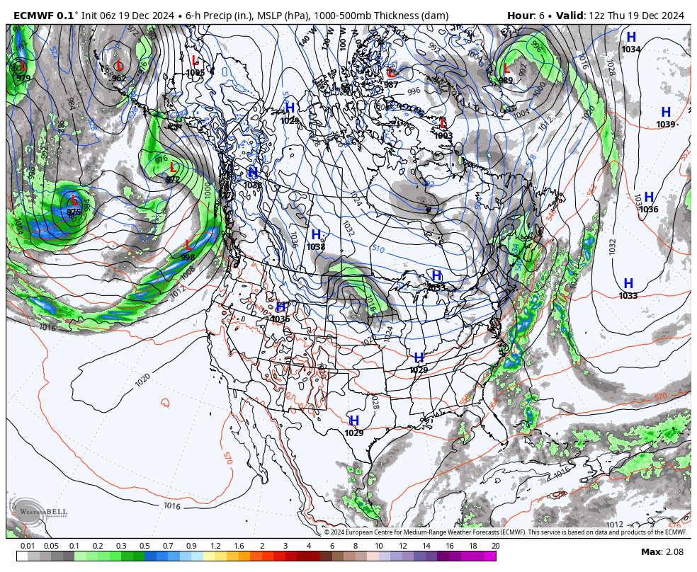
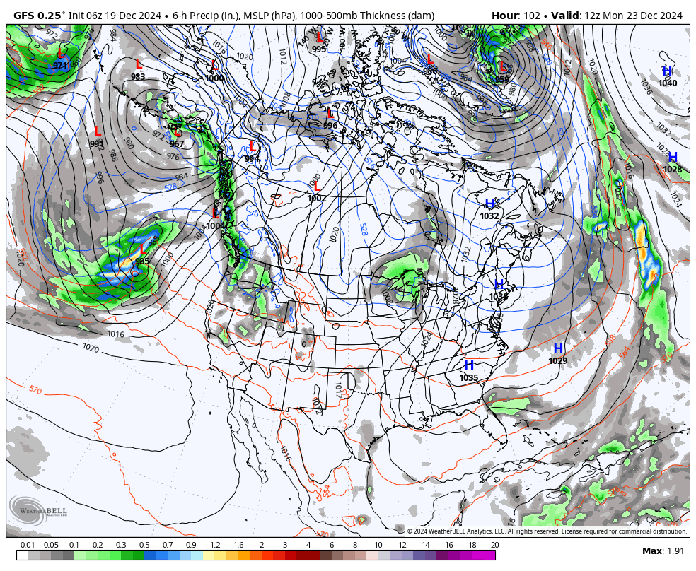
These are the EURO & GFS Deterministic Models for Dec 24th at 0700hrs Euro 0.1º - 6hr Precip, MSLP, 850mb GFS 0.25º - 6hr Precip, MSLP, 850mb


Euro 0.1º - 24hr MAX 2m Temps (ºf) GFS 0.12º - 24hr MIN 2m Temps (ºf)


Cali Pass Resorts Forecast: December 19, 2024
Bear Valley Summary: Will remain dry through Friday before entering an active weather pattern this weekend. The first wave arrives Saturday with light snow above 6,500 feet. A second wave Sunday brings a mix of rain and snow, with minimal accumulations due to high snow levels. By Tuesday, snow levels are forecast to drop down into the 5,000 ft range.
China Peak Summary: Warm, dry weather through Friday before transitioning to a more active weather pattern. Light snow is possible on Saturday, but a more impactful storm arrives on Tuesday with heavy snowfall and dropping snow levels. Travelers and resort operations should prepare for potential disruptions. Stay updated with weather forecasts as conditions evolve.
Dodge Ridge Summary: Mild and dry conditions through Friday, with frost expected in the mornings. A storm system brings a chance of rain and snow starting Saturday and continuing through midweek. Significant snowfall is expected Tuesday as snow levels drop to 5,000 feet. Christmas Day looks clear but cold with widespread frost. Plan for changing mountain conditions early next week.
Mountain High Summary: Dry conditions will persist through the weekend. A cooling trend begins Monday, with a chance of rain and snow showers on Tuesday. Christmas Day looks sunny and cold, ideal for holiday mountain activities.
Long Range Models - MotherNature Opening up the Storm door!
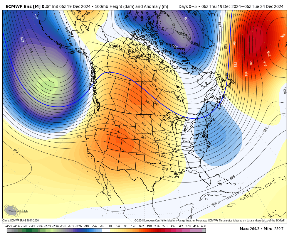
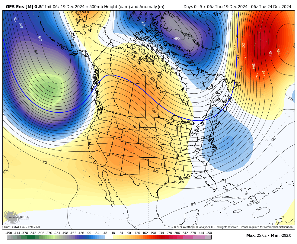
Stay tuned and Stay Thirsty, my friends. We have a great weather pattern ahead, with a lot of potential for Base-building and the possibility of #ColdSmokeChristmasWednesday ahead. Stay'nThirsty for POW Coop


